

AIROBO Infinity Private Limited is one of the fast-growing companies providing the one stop solution for all your Drone related needs under the areas as Academy, Services, Solutions, Platform & Product.
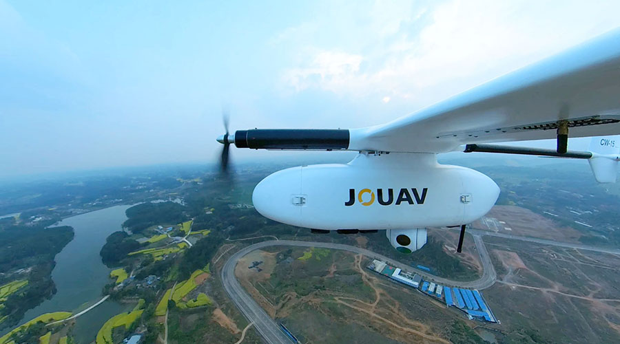
Custom drones are one of key areas of expertise and accelerating business growth for our clients. These drones are used in a variety of industry sectors, including Mining, Renewable energy (Solar, Windmill), Construction/Infrastructure, Agriculture, Marine, Aviation, Oil and Gas, Security, and Surveillance. Thanks to our many years of expertise, we can service all kinds of Drones and design unique drone solutions for a variety of applications, including Military Usage, Delivery, Emergency Rescue, Agriculture, Wildlife/Historical Preservation, Medicine, and Photography.
Our specialized drones are used in the Media industry for over 500 films, over 100 products and marketing shots. Most significantly, for more than 12 years, we have offered Aerial Filming solutions to most of the top Indian blockbusters films. We also successfully trained & provided solutions to Govt agencies across India. This demonstrates our versatility and flexibility to modify drones to meet the specific needs of various sectors and businesses.
Our Mission
Our commitment lies in offering cutting-edge Drone solutions that improve Productivity, Safety and Efficeincy in a variety of industry sectors like Mining, Renewable energy ( Solar/Windmill), Construction/Infrastructure, Agriculture, Marine, Aviation, Oil and Gas, Security and Surveillance.
Our Vision
our vision is to be a trusted leader in the Drone industry, driving Innovation, delivering excetional Customized solutions, streamlining operations for our esteemed Clients and enhancing their overall Customer experience.
Clients
Projects
Ad Films
Feature Films
Our Solutions
We provide best solutions for our customers in the following industries.

Geospatial and Engineering
We are providing services in Mapping Solution (Digital Photogrammetry, LiDAR, Mobile LiDAR, ORTHO, GIS,and CAD etc.) Survey(DGPS/Total Station, UAV Drone And Airbon LiDAR) Our Services are Quality assured, Timely Executed with an affordable competitive pricing.
Our Services covers,
PHOTOGRAMMETRY,LiDAR/Mobile LiDAR,ORTHO IMAGE PROCESSING,GIS,CAD,DGPS/TOTAL STATION SURVEY,UAV/DRONE SURVEY,AIRBON LIDAR SURVEY
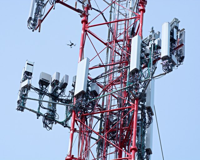
Telecommunications
Drones can be used to inspect cell towers and other telecommunication infrastructure for damage, wear and tear, or maintenance needs. They provide a safer and more cost-effective alternative to manual inspections that require climbing.With drones, there is no need to cause downtime or endanger workers.

Security & Surveillance
Drones can be used for a variety of surveillance purposes from providing site security surveillance to monitoring crowds at sports events and festivals. Use of infra-red/night vision technology can aid visibility in unlit areas or at night.

Military & Defence
Drones can conduct surveillance missions by hovering over an area for an extended period. Command and Control –Drones can relay crucial information on enemy movements, locations, and positions of strategic targets.

Logistics
The drone does a fly-by over the customer's house and releases the package, which parachutes down to the owner's house.They can navigate through traffic and deliver packages to remote or hard-to-reach locations, reducing delivery times.Logistics drones can deliver goods to rural or underserved areas where traditional infrastructure may be lacking.

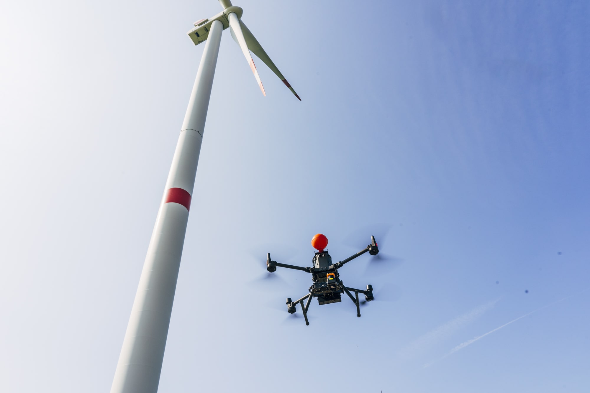
Energy
Drones can quickly and easily survey large solar sites, providing valuable data on the terrain, vegetation, and existing infrastructure. This information can be used to optimize the placement of solar panels, identify potential hazards, and plan for future expansion. Drones can also inspect solar panels for problems such as dirt, cracks, and shading. This can be done quickly and easily, without the need to shut down the solar plant.

Agriculture
Drones can help farmers to optimize the use of inputs (seed, fertilizers, water), to react more quickly to threats (weeds, pests, fungi), to save time crop scouting (validate treatment/actions taken), to improve variable-rate prescriptions in real time and estimate yield from a field.

Oil & Gas
Drones can monitor gas emissions, perform safe 3D mapping and carry out intricate inspections of pipelines, drilling sites, and oil platforms.Drones make it possible to inspect pipelines to inspect right-of-way, encroachment/access issues, and leaks. .

Medicial & Health
By using drones, healthcare providers can deliver essential items like medicine and lab reports, and they can even provide periodic inspections for safety purposes.
Aerial Filming
Cinematic Vision from an aerial perspective: Aerial photography is a technique of photographing the Earth’s surface or features of its atmosphere or hydrosphere with cameras mounted on aircraft, rockets, or Earth-orbiting satellites and other spacecraft. Drones and, possibly, our favorite, the helicopter, fall under this category. Our licensed drone pilots use a variety of drones to complete even the most menial of tasks. Get amazing perspective images for highly specialized tasks like following a specific subject. With pride, we uphold our artistic cinematography with safety precautions in place. To take your project to new heights, we may use drones and even helicopters to take 360-degree photographic views for virtual tours and site inspections.
Aerial photography are useful as a mapping tool because they may display a far wider area than can be captured in a ground shot, and it is simpler to ascertain the precise scale of items.
Give us a call for a free estimate if you would like additional details or to see an example of what your project might look like.


Research and Development
For research and development, use R&D. We will now delve into a much broader and more complicated subject of what R&D stands for in a corporate environment and its power.
To further the company's purpose to manage, develop, defend, and provide relevant sophisticated software/Drone solutions, the Research and Development Office (R&D) applies science and technology.
The creation of new knowledge is what research and development do. It is a task that businesses carry out in order to create new goods, methods, or services, or to enhance ones that currently exist. Businesses frequently assume risk in order to achieve this. This is due to the fact that it is unclear whether what they are attempting is technologically doable or, more frequently, that they are unsure of how they will actually accomplish their goals.
For many businesses, R&D is a crucial task. A company can stay profitable and competitive by introducing new products or upgrading existing ones.
R&D is one of the initial stages of creating a new product, process, or service or improving one that already exists. At this time, danger and innovation are frequently in abundance. In the R&D cycle, ideation and theorizing are frequently followed by research and exploration, design, and development.

- Many different industries, businesses of all sizes, and sectors engage in research and development. These include sectors like food and drink as well as highly-reliant R&D industries like pharmaceuticals, life sciences, automotive, software, and technology. Additionally, R&D is crucial to the construction sector, particularly in the fields of IT, manufacturing, and engineering.
- Ideas and theories are the foundation of any R&D, whether it be to identify problems or uncover new opportunities. The next step in the R&D process is to investigate and research those concepts to determine their viability.
- The development phase requires prototyping since it enables you to find problems, solve them, and enhance the design.
What industries engage in R&D?

- New product research and development
- R&D and product development frequently work together. There is always a need to adapt because of the quick changes in consumer needs and new technologies. You must have a thorough awareness of the market and user requirements before creating new goods. The foundation for the creation of the new product is thus laid.
- Agriculture Drones (Drones)
- Emotion capture (AI)
- Lip sync (AI)
- Instruction thru Reactions (AI)
- Robotic Arm (AI)
- Switch control of Motors (AI)
R&D can be organized to consider a variety of outcomes, including:
At first, several ideas are generated and tested. These can then be tested and researched further using prototypes. Here are a few of our forthcoming projects.

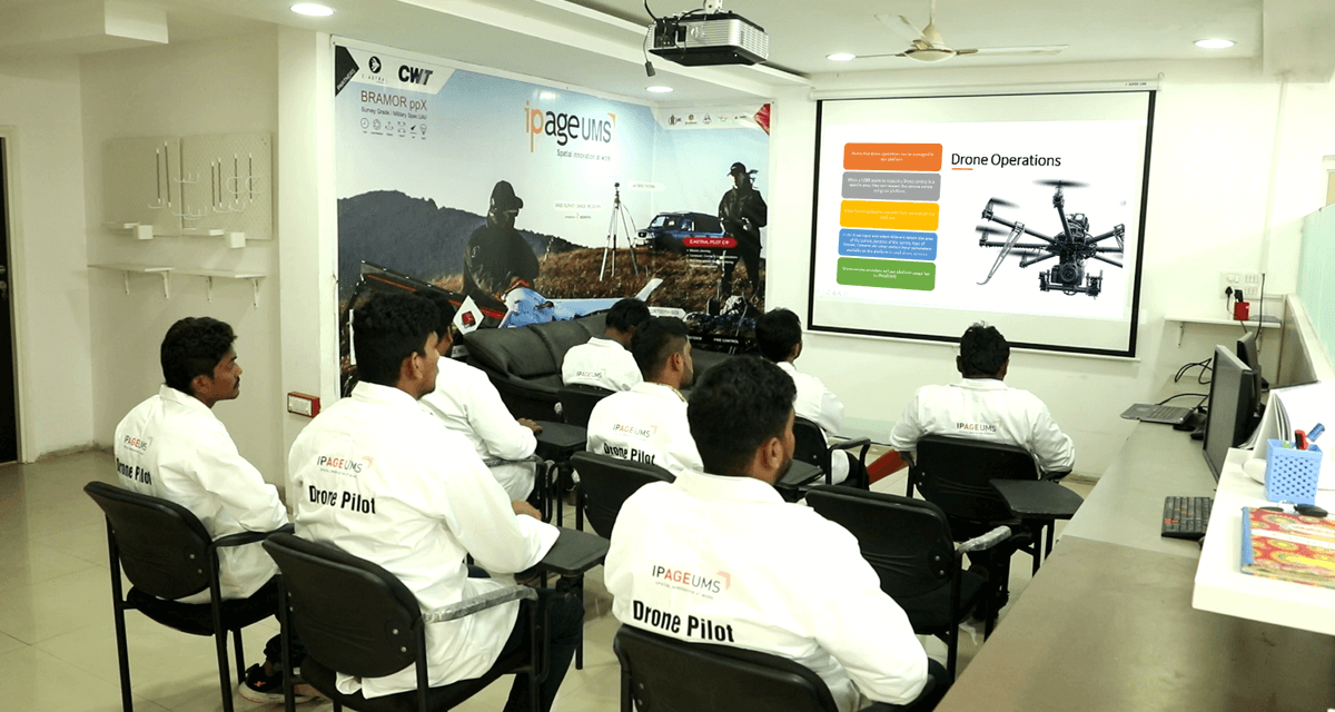
Academy
We are happy to announce a new collaboration between India Drone Academy(IDA) by iPageUMS and AI ROBO Private Ltd.
- India Drone Academy (iPageUMS) offers the best drone pilot instruction in the country to individuals, businesses, government organizations, and public safety sectors. And as you may have be aware, we offer the greatest software solutions using customized drones and AI technologies.
- We are considering expanding the offerings through tight collaboration. Our main goal is to please the client by offering our top-notch services. With this agreement, we will undoubtedly be able to expand and improve our company while also offering novel training and academy services.
- Our highly skilled crew has extensive background in the drone business expanded to the quickly expanding UAV (Drone) market in the commercial sphere. Consequently, the DGCA will certify our students as drone pilots (IDA). We also periodically affiliate with various organizations around the country for creating a better career for our students.
- Learn how confidently fly drones and sharpen your pilot skills by tackling our worthy drone pilot training program to satisfy your drone dreams. Uncover your latent capacity, and we should praise the mission of drones together!
Course Curriculum Link : https://www.indiadroneacademy.com/drone-pilot-training/
Drone Pilot Training :
Our capable and qualified team of expert trainers endeavor to push you to more prominent pinnacles.

Projects
Ongoing Projects
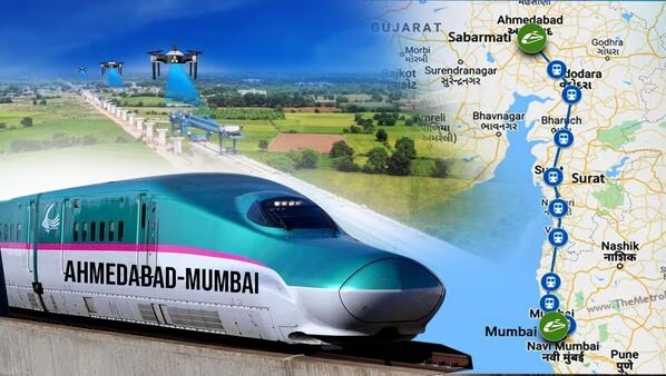
Mumbai to Ahmedabad Bullet Train Project (NHSRCL) - (2022-2023)
- High-Precision Surveying and Mapping: The project will leverage state-of-the-art drone technology equipped with advanced imaging and LiDAR capabilities to conduct high-precision surveying and mapping of the Mumbai to Ahmedabad bullet train corridor.
- Detailed Infrastructure Assessment: Customized UAVs will be deployed to capture detailed 3D models and imagery of key infrastructure elements, including tracks, stations, and bridges, enabling a comprehensive assessment of the entire project area.
- Efficient Environmental Impact Assessment: Drones will play a crucial role in monitoring the environmental impact of the project, including assessments of vegetation, water bodies, and other natural features along the corridor, ensuring compliance with environmental regulations.
- Enhanced Safety and Cost-Efficiency: The use of drones will improve safety by reducing the need for manual inspections in potentially hazardous areas. Additionally, the efficiency of data collection and analysis will lead to cost savings and more informed decision-making throughout the project's lifecycle.
- Precision Aerial Surveys: Advanced drone technology will be employed to conduct precise aerial surveys of the Chennai, Bangalore, Hyderabad, and Delhi-Meerut metro train project sites, providing high-resolution imagery and topographical data.
- Comprehensive Infrastructure Mapping: Customized UAVs equipped with cutting-edge imaging and LiDAR capabilities will capture detailed 3D models and imagery of critical infrastructure components, including stations, tracks, and tunnels, enabling a comprehensive assessment of the entire project area.
- Environmental Compliance Monitoring: Drones will play a pivotal role in monitoring the environmental impact of the metro train projects, conducting assessments of vegetation, water bodies, and ecological features along the routes, ensuring adherence to environmental regulations.
- Enhanced Safety and Efficiency: The use of drones will enhance safety by reducing the need for manual inspections in potentially hazardous areas. Additionally, the efficiency of data collection and analysis will lead to cost savings and more informed decision-making throughout the projects' lifecycles.
Chennai, Bangalore, Hyderabad, Delhi-Meerut Metro Train Projects with L&T - (2022-2023)

Previz for Indian 2 Movie - Lyca Productions
- Aerial Cinematic Previsualization: The previz for the Indian 2 movie utilized drone technology to create realistic aerial shots and sequences that were crucial for visualizing key scenes in the film.
- Advanced Drone Capabilities: Customized drones equipped with high-resolution cameras and advanced stabilization systems were deployed to capture dynamic aerial footage, providing a realistic preview of how the scenes would look in the final production.
- Enhanced Cinematic Experience: The use of drones in previz allowed the filmmakers to experiment with various camera angles, movements, and perspectives, enhancing the overall cinematic experience and ensuring that every shot was meticulously planned.
- Efficient Production Planning: By incorporating drones into the previz process, Lyca Productions was able to streamline production planning, ensuring that resources were allocated efficiently and that the filming process was executed with precision and creativity.

- Advanced Drone Technology Integration: The Indian Government is incorporating cutting-edge drone technology across various projects in 2023, revolutionizing data collection, surveying, and monitoring processes.
- Efficient Infrastructure Assessment: Customized UAVs equipped with advanced imaging, LiDAR, and other capabilities are being deployed to conduct precise assessments of critical infrastructure elements, optimizing planning and maintenance efforts.
- Environmental Impact Monitoring: Drones are playing a pivotal role in monitoring the environmental impact of government initiatives, conducting assessments of vegetation, land use, and ecological features to ensure sustainable development practices.
- Enhanced Safety and Accuracy: The use of drones significantly enhances safety by reducing the need for manual inspections in potentially hazardous areas. Moreover, the efficiency of data collection and analysis leads to more informed and accurate decision-making throughout the lifecycle of the projects.
Indian Govt Projects - 2023
Completed Projects
Orrisa Slum Developments Survey - 2022
- Innovative Technology for Urban Development: The 2022 Orissa Slum Developments Survey utilized cutting-edge drone technology for urban planning and development.
- Aerial Insights with Advanced UAVs: Customized UAVs equipped with cutting-edge imaging and LiDAR capabilities provided an unprecedented aerial perspective of slum areas in Orrisa.
- Precise Mapping for Targeted Interventions:The collected aerial data, comprising high-resolution imagery and detailed 3D models, facilitated precise mapping of critical aspects including infrastructure, housing conditions, and environmental factors.
- Empowering Communities Through Technology: The data empowered evidence-based decision-making, facilitating targeted interventions. Interactive workshops engaged and educated community members about the potential applications of this technology, fostering a sense of ownership and empowerment among residents, and emphasizing the pivotal role of technology in enhancing urban living conditions.

- Drone-Enabled Site Assessment: The survey leveraged drone technology to conduct comprehensive site assessments across various locations in Maharashtra, providing a bird's-eye view of Adani's green energy projects.
- High-Precision Data Collection: Customized UAVs equipped with advanced imaging capabilities were deployed to capture high-resolution imagery and detailed 3D models, enabling precise data collection for accurate project planning and implementation.
- Efficient Infrastructure Planning: The aerial data obtained through drones facilitated detailed mapping of existing infrastructure, allowing for optimal placement of renewable energy assets and streamlining the overall project layout.
- Enhanced Environmental Impact Assessment: Drones played a crucial role in assessing the environmental impact of Adani's green energy initiatives. This included monitoring vegetation, water bodies, and other natural features to ensure sustainable development practices.
Adani's Green Energy Endeavor in Maharashtra - 2022
Statkraft Infrastructure Survey - 2021
- Advanced Aerial Imaging: The survey employed state-of-the-art drones equipped with high-resolution cameras and LiDAR technology to capture detailed aerial imagery and topographical data, providing a comprehensive view of the infrastructure.
- Precise Data Collection: Drones played a pivotal role in collecting accurate and granular data about the existing infrastructure, enabling in-depth analysis and assessment for maintenance, optimization, and future development.
- Efficient Asset Management: The aerial data obtained through drones facilitated efficient asset management by allowing for the identification of areas in need of repair, upgrade, or replacement, optimizing resource allocation.
- Enhanced Safety and Accessibility: Drones provided a safe and efficient means to inspect and assess hard-to-reach or hazardous areas, reducing the need for manual inspections and ensuring the safety of personnel.

- High-Precision Aerial Mapping: The survey utilized advanced drone technology equipped with high-resolution cameras and LiDAR capabilities for precise aerial mapping of the Tamil Nadu Papanasam Dam and its surrounding areas.
- Detailed Infrastructure Assessment: Customized UAVs were deployed to capture detailed 3D models and imagery, allowing for a comprehensive assessment of the dam's structural integrity, as well as an analysis of surrounding infrastructure.
- Environmental Impact Evaluation: Drones played a crucial role in monitoring the environmental impact of the dam, including assessments of vegetation, water bodies, and ecological features, ensuring sustainable development practices.
- Improved Safety and Efficiency: The use of drones significantly improved safety by eliminating the need for manual inspections in potentially hazardous areas. Additionally, the efficiency of data collection and analysis was greatly enhanced, leading to more informed decision-making.
TamilNadu Papanasam Dam Survey - 2020

Indian Oil Green Energy Survey- 2019
- High-Precision Aerial Mapping: The survey utilized advanced drone technology equipped with high-resolution cameras and LiDAR capabilities for precise aerial mapping of the Tamil Nadu Papanasam Dam and its surrounding areas.
- Detailed Infrastructure Assessment: Customized UAVs were deployed to capture detailed 3D models and imagery, allowing for a comprehensive assessment of the dam's structural integrity, as well as an analysis of surrounding infrastructure.
- Environmental Impact Evaluation: Drones played a crucial role in monitoring the environmental impact of the dam, including assessments of vegetation, water bodies, and ecological features, ensuring sustainable development practices.
- Improved Safety and Efficiency: The use of drones significantly improved safety by eliminating the need for manual inspections in potentially hazardous areas. Additionally, the efficiency of data collection and analysis was greatly enhanced, leading to more informed decision-making.

Our Happy Customers
We're proud of our strategies and some companies
We're proud to work with


MEET OUR TEAM
Mr. E.Parthiban
Chief Executive Officer
Parthiban, an Entrepreneur, has expertise in financial management, budgeting, risk management and fund raising & extensive experience and track record of leadership in the construction and IT industries. Currently, as our Chief Executive Officer and partner, spearhead our business's ongoing success with a passion for innovation, a dedication to our basic principles, and a vision for the future. He also holds a position as Project Director of Goodlink Engineering & Construction Pte Ltd & CEO of CKM India private limited.

Mr.Ganesh Rajendran
Managing Director
(Indian Ops & R&D)
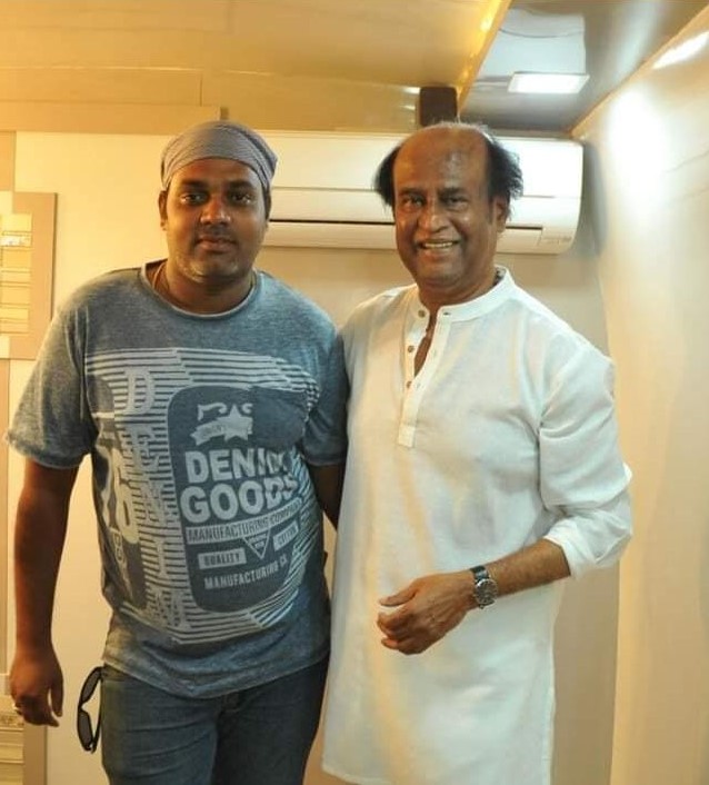
Ganesh Rajendran, a talented AI architect/IT developer with 20 years of experience, launched "Inconnect Media" in 2011 as a media and entertainment company. This venture is notably a part of Global Productions(MSME), and its main purpose statement is to support creators' ideas and creativity. He is also an award-winning Document Director, showcasing his exceptional leadership and originality. Furthermore, Ganesh Rajendran has received accolades for his work as an AI architect, highlighting his excellence in this field. He later formed "AiRobo Infinity Private Limited," a company with a revolutionary concept in the drone sector, and managed the entire India operations (Academy/Franchise/R&D) due to his primary passion.

Mr. Deepak Christopher
Director
(Products & Government Projects)
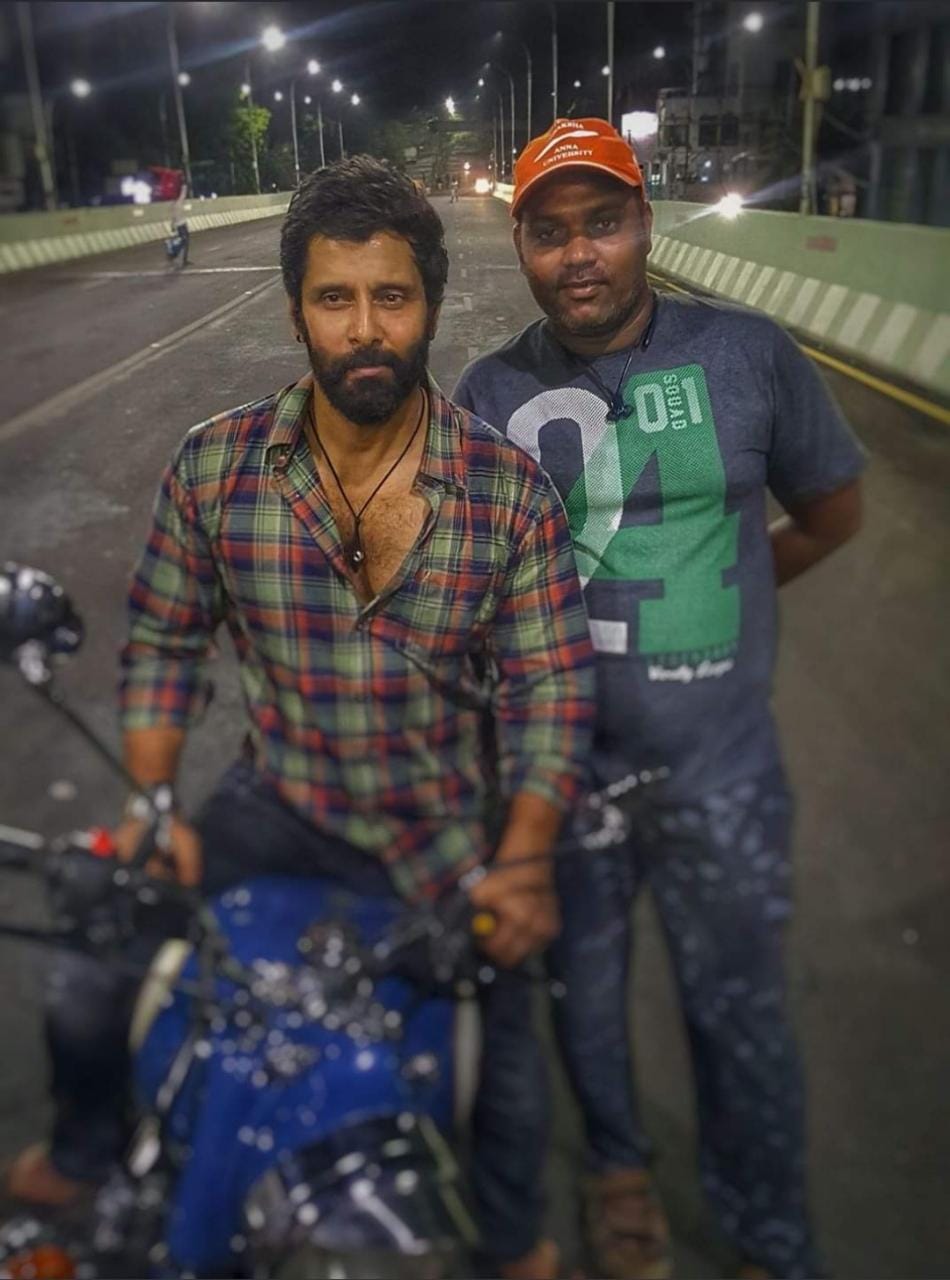
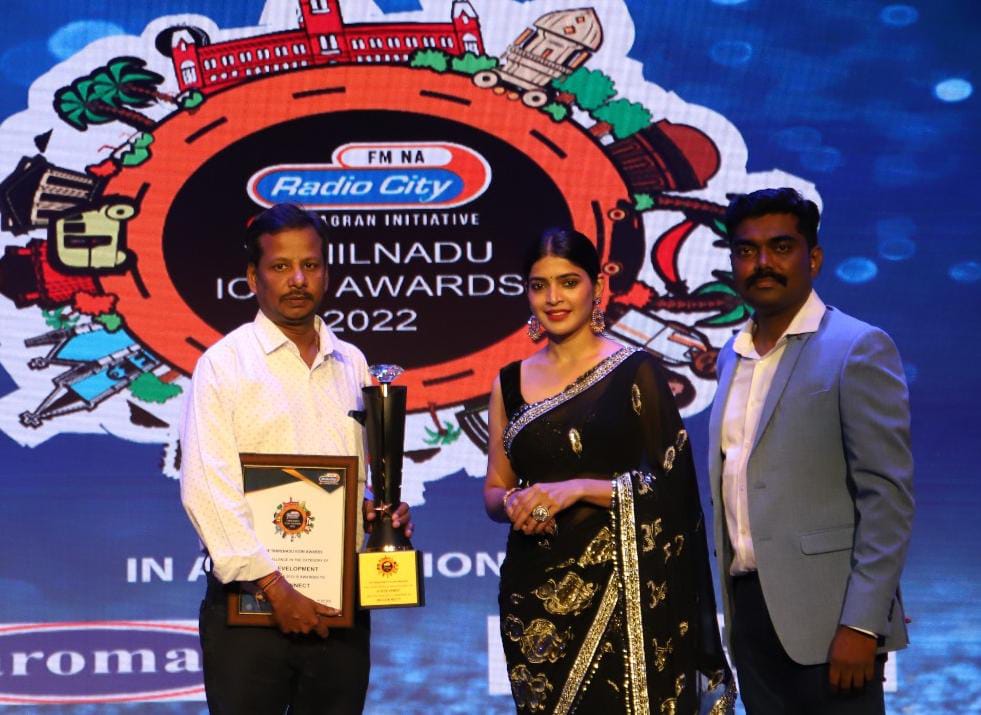
Leading aerial photographer Mr. Deepak Christopher works in the Tamil, Telugu, Malayalam, Kannada, and Hindi film industries. He also performs aerial photography for a variety of commercial enterprises and governmental initiatives, like the bullet train, the Chennai Metro, etc. and runs a media company called Madras Medias as a CEO & co-founder/Director of AiRobo Infinity Private Limited.

Mr.G.Saminath
Vice President
(Global Biz Development - Singapore)
Saminath Gunasekar is holding the Director of Global Business Development, Strategic Alliances & Technology division, and partner of AIROBO INFINITY Private Limited. As a Multi- and Social-entrepreneur, his main areas of expertise are Digital/Technology strategy and successful Business Process Transformation. With an IT background, he has effectively created a varied portfolio of business enterprises spanning several industries, such as Restaurants, Construction, IT consulting, Drones (UAV), and Entertainment [VR Mobile games and Metaverse platforms are the upcoming projects].
Newsletters
Message From CEO

Solutions

Contact
Want to get in touch? We'd love to hear from you. Here's how can you reach us...
Our Main Office
No.4, Neduncheziyan Salai
Sholinganallur
Chennai-600 119
Our Branch Office
No.2 1st Cross Street, LIC Colony
Medical College Road,
Thanjavur - 613001
Email Us
support@airoboinfinity.com
Call Us
+91 9894348767
+65 8102 2144
+91 9615300900